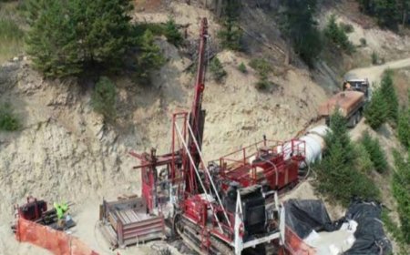
Angus Gold beats historical assays at Golden Sky project in northern Ontario
Angus Gold (TSXV: GUS; US-OTC: ANGVF) says new drill results “significantly” improve on historical assays in some areas of the Dorset zone of its Golden Sky project in northern Ontario.


Hole GS-23-73 cut 16 metres grading 2.8 grams gold per tonne including 8 metres at 5.1 grams gold, and hole GS-23-72 returned 16 metres grading 2.2 grams gold including 6 metres at 3.4 grams gold, Angus said in a news release on Wednesday.
This week’s results compare with 47 intersections from 16 years ago on the property just north of Lake Superior, about 300 km east of Thunder Bay. Those assays showed at least 1.5 grams gold per tonne over lengths from 1 metre to 19.1 metres, according to a 2007 resource estimate by MetalCorp and Trelawney Resources. It reported 780,000 indicated tonnes grading 1.4 grams gold for 40,000 oz. of gold and 4.76 million inferred tonnes grading 1.1 grams gold for 180,000 oz. gold.
“Our key objectives at the Dorset zone continue to be strike extension and discovery of higher-grade zones,” Angus Gold CEO Steve Burleton said in the release. “These results also demonstrate that we can improve upon the historical results from Dorset, which bodes well for future resource estimates.”
Angus’ winter drill program saw nine of the 15 holes targeting infill at 25-metre spacing while others drilled high-grade material within the historical resource area for a future resource update, the company said. The Dorset zone lies within the under-explored Mishi Creek Deformation Zone, which runs 7 km into the Golden Sky project. The 234-sq.-km project lies between Wesdome Gold Mines’s (TSX: WDO) Eagle River and Mishi open-pit gold mines.
“Results from all nine holes were successful at intersecting Dorset style gold mineralization within the Dorset zone resource area and in some areas has significantly improved upon the historical drilling results,” the company said.
This week Angus begins more drilling, this time focused on the BIF gold zone in a large banded iron formation and some new regional exploration targets, including the Splay zone target south of BIF, Angus said.
Exploration of the property 50 km west of Wawa dates to at least 1970, when Falconbridge Nickel Mines conducted surveys. Noranda and Murgor Resources also explored the site, but no resource was estimated until MetalCorp and Trelawney. Angus began an earn-in acquisition of part of the property in 2014 from Talisker Resources (TSX: TSK; US-OTC: TSKFF), and other parts from Iamgold (TSX: TSX: IMG; NYSE: IAG) in 2020, which it completed in January.
In March, Angus said drill results extended the strike length of the Dorset zone 450 metres to the west, which combined with an eastern extension a month earlier for a strike length of almost 1 kilometre.
Gold mineralization in the Dorset zone occurs primarily in carbonate-altered, sulphide-mineralized zones, Angus said in a 2020 report. The gold is associated with pyrite and arsenopyrite, with trace amounts of pyrrhotite and chalcopyrite.
“The Dorset property is underlain by metavolcanic rocks to the north and metasedimentary rocks to the south,” geologist Robert Kusins wrote in a 1999 report. “Sequences of mafic metavolcanic rocks are exposed along the southern portion of the property. The mafic metavolcanic rocks are dominated by massive to pillowed flows which have been metamorphosed to upper greenschist facies.”
Shares in Angus Gold rose 3.8% on Wednesday to 83¢ apiece, within a 52-week range of 64¢ and $1.19, valuing the company at $40.8 million.

